Rangeland rehabilitation, invasive species control, and monitoring across the large, rugged, and remote acreage public agencies manage.
Public lands span exactly the kind of country drones handle best — steep, remote, and too large for ground crews to cover efficiently. AgriFlyt delivers targeted treatment and high-resolution data with reduced risk, lower cost, and complete records suited to agency reporting.
Aerial seeding and cover establishment for restoration, post-fire recovery, and sustainable grazing.
Targeted treatment of invasive species for BLM and Forest Service lands — precise, documented, and repeatable.
Multispectral and high-resolution mapping to support NRCS soil health and erosion programs.
Orthomosaics, terrain models, and condition assessments for city and county land management.
Licensed applicators, FAA Part 107 and Part 137 certification, full insurance, and detailed as-applied records and maps for every project. See our credentials →
Multispectral mapping lets us target only the areas that need treatment and quantify results over time — reducing chemical use and producing the kind of evidence agencies value for environmental stewardship and reporting.
See precision mapping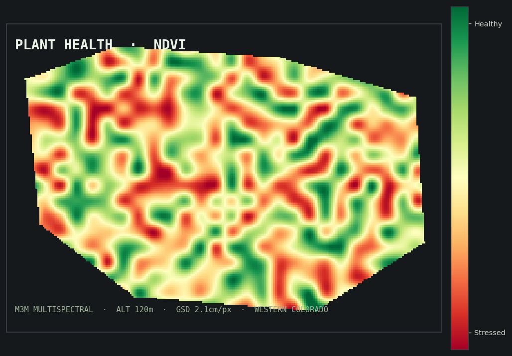
Share the scope and acreage — we'll outline an approach and a quote.
Request a Quote